“The world is full of magic things, patiently waiting for our senses to grow sharper.” – W.B. Yeats
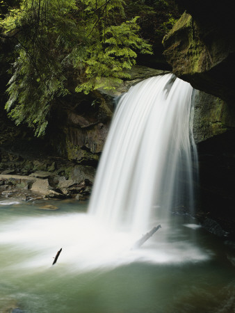
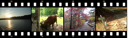
A little over a week ago, we were enjoying one of our beloved day trips through beautiful Kentucky when we spied the icicles above. We were on our way to London, Kentucky – driving through the gorgeous Daniel Boone National Forest on Highway 80.
This picture was taken near Rockcastle River, right as you head into Laurel County. It’s a gorgeous drive, no matter what time of year it is.
Below are a few facts about this beautiful National Forest.
Facts About the Daniel Boone National Forest
- Daniel Boone National Forest is the only National Forest completely in the boundaries of Kentucky.
- The forest lies in the Cumberland Plateau. The Cumberland Plateau is a beautiful region with lush, thick, forested hills, sandstone cliffs and ravines.
- One of the world’s largest concentrations of caves lies in the Daniel Boone National Forest.
- According to The Daniel Boone National Forest’s Official Page, the forest spreads across 21 counties. According to Wikipedia, the forest spreads across 17 counties.
- The forest contains three large lakes: Cave Run Lake, Laurel River Lake and Lake Cumberland.
- People flock to this area for fishing, picnicking, rock-climbing, hiking, horseback riding, photography, and relaxation.
- Over 708,000 acres make up the Daniel Boone National Forest.
- The forest was officially established in 1937 under a proclamation signed by President Franklin D. Roosevelt. It was originally named the Cumberland National Forest but was renamed in 1966 in honor of Daniel Boone.
- The Daniel Boone National Forest has one photo opportunity after then next, including beautiful natural arches. Did you know that Kentucky has more natural stone arches than any state in the eastern United States?
- Rivers in the area include the Red River, Rockcastle River and Cumberland River.
Visit the Daniel Boone National Forest Website for more information, events, things to do, and pictures.